The final stretch of the Renaissance Ring takes us on a superb hike from Impruneta, the land of terracotta, through Galluzzo and the magnificent Certosa, to finally reencounter Signa on the banks of the Arno river. Florence reveals itself in all its splendor several times along the way, as we cross olive groves, vineyards and woodlands. It’s a great ending for a very rewarding trail.
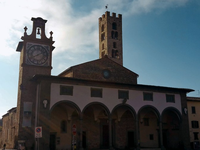
We depart from Impruneta but not before checking out the charming 11th century church of Santa Maria dell’Impruneta and its elegant 17th century portico. Unfortunately, the interior was mostly destroyed during WW2, including its carved wood ceiling in baroque style. There are some 1940s photos by the entrance that will give you an idea of the magnitude of this disaster. Luckly, the small temples on the right and left sides of the altar survived with their exquisite 15th century panels in glazed terracotta by Luca della Robbia. They also house a 13th century image of the Virgin Mary, fervently worshipped by locals for having saved Impruneta from the plague and other hazards. If you are interested in religious artifacts, you should visit the treasury museum within the church, it’s one of the best in Tuscany.


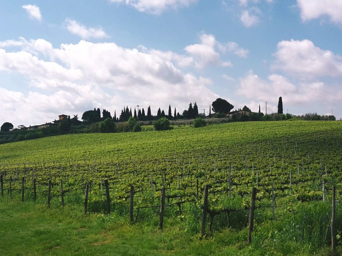
We go up on Via Leopoldo Vanni, but not without noticing a couple of exquisite terracotta vases decorating the main square, prime examples of Impruneta’s great craftsmanship. We walk on Provincial Road n.70, direction Florence, for about a mile. There is a sidewalk for most of the way, and we can enjoy the bucolic scenery with San Casciano in Val di Pesa on the southwest hills. We take Via Quintole per le Rose uphill to Monte di Meccoli, and we’ll continue on this road almost until Galluzzo, passing by the sleepy neighborhoods of Baruffi and Le Rose and two lovely 12th century churches – San Miniato a Quintole and San Lorenzo alle Rose, both in medieval romanesque style. We turn right in Via Brancolano by Villa Antinori delle Rose, which once belonged to the noble winemaking family and now is available for events and lodging. As we approach Galluzzo, we enjoy a fantastic view of the Certosa, and of the convent of San Paolo, on the hill across the highway. Don’t get too distracted. We arrive at a parking area at the bottom of this path without any trail marks on sight. Go straight ahead to Via Senese, cross it, turn right and then left in Via di Colleramole – the Renaissance Ring continues from here.


The Charterhouse of Galluzzo 
San Miniato a Quintole
I’d recommend a detour to visit the Certosa, but make sure you check the times of the guided visits. The wealthy Acciaiuoli family funded the construction of the imposing charterhouse in 14th century and to this date a handful of cistercian monks live an austere life within its cloisters. They substituted the original and stricter carthusians in 1958. Continuing the hike, from via di San Cristofano we enjoy great views of the church of San Lorenzo within the walls of the Certosa. Further up the road, we witness an extraordinary panorama of Florence, it’s hard to turn your back and proceed on the trail. Soon, we pass by extensive vineyards and the elegant 16th century Villa I Collazzi before reaching Via Volterrana. We’ll follow this provincial road for a few hundred yards – pay attention to the trail marks around this area – we get out of the road on the left after the guard rail, then go up through a path in the woods and turn right to go down, returning to Via Volterrana.
Convent of San Paolo 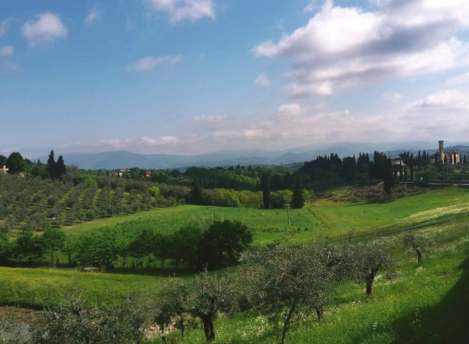
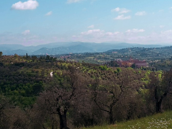
Beautiful Florence lies behind these hills
We cross the road and continue on another downhill path to the left. We quickly get to the bottom and make a u-turn to take the path in the woods to Casignano. Here, we may spot some local wildlife like deer and fox while enjoying a pleasant hike among oak, pine and chestnut trees. After Casignano, we head towards Pian de’ Cerri passing by the rustic chapel of San Zanobi, where the 4th century patron saint of Florence spent some time in contemplation. By La Catena, the path opens to a gorgeous view of the hills around Chiesanuova and we can spot the bell tower of Santa Maria dell’Impruneta in the distance. We continue along the fence of Poggio Valicaia park (don’t go into the park) to arrive in Pian de’ Cerri. We make another u-turn into Via di Mosciano to soon take a left into Via di Fabbrica and another one into Le Pozze. This dirt path makes true to its name: after a rainy day there are plenty of puddles along the mudded way.

San Romolo in Lastra a Signa 
Can you spot the bell tower of Santa Maria dell’Impruneta in the faint background?
By Roncigliano, we meet asphalt once again. After we pass vineyards and a private property, we take a left into Via Roveta. The trail contours the hill taking us down to Via delle Fonti where we cross a bridge over the FI-PI-LI highway and reach Via di Naiale. The historical center of Lastra a Signa is less than an hour away. As we approach it, walking on Via San Romolo and Via di Poggio Vittorio we have a chance to enjoy a wonderful view of Signa, perched on the hill across the Arno river, and the plains of the Bisenzio river where we started our hike on the Renaissance Ring. We enter the town through Portone di Baccio, one of the city gates, and pass by the 15th century Spedale di Sant’Antonio and its beautiful loggia. We turn left on Via 24 Maggio to reach Signa through Porta Pisana – the gate that opens to Pisa. We’ll go under the railway and then the road, before finding a pedestrian bridge that crosses the Arno by Piazza Guido Andrei.

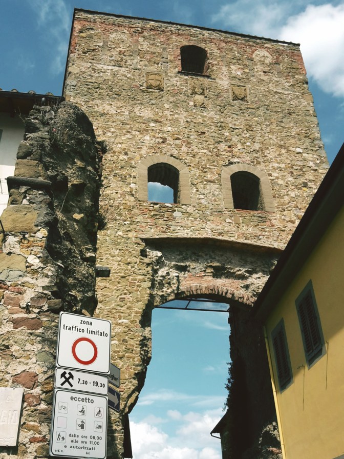
Portone di Baccio, Lastra a Signa 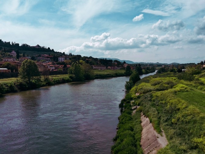
Crossing the Arno to reach Signa
It’s bittersweet. It feels great to close this 105 mile (170km) loop through the majestic Florentine countryside. But I wish this wasn’t the end. Well, I’m already planning to come back and hike on the opposite direction – maybe I’ll bring some friends with me. Happiness is to be shared, after all. I have new adventures in my near future plans, including hiking the main circular trail around the Apennines. Stay tuned!

The Florentine Valley and the mountains of Calvana and Monte Morello
I hope you liked this post! Send me your comments so this blog keeps getting better!

Impruneta – Galluzzo
- 1h30
- 4.3 miles (6.9 km)
- Arrive: Impruneta (by bus)
- Depart: Galluzzo (by bus)
- How to get there: 20 min bus ride from Busitalia SITA Nord Autostazione (by Firenze SMN train station).

Galluzzo – Pian de’ Cerri – Signa
- 5h
- 14.3 miles (23 km)
- Arrive: Galluzzo (by bus)
- Depart: Signa (by train)
- How to get there: ATAF bus n. 11 from Piazza Santa Maria Novella.
Thank you for the detailed recommendations! I’m here now on vacation from Denver and want to get a hike in…

Happy to learn that my posts were helpful! Enjoy your hike!