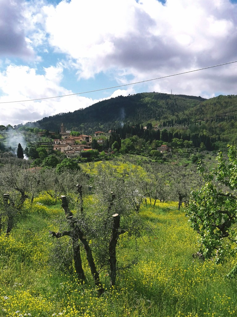
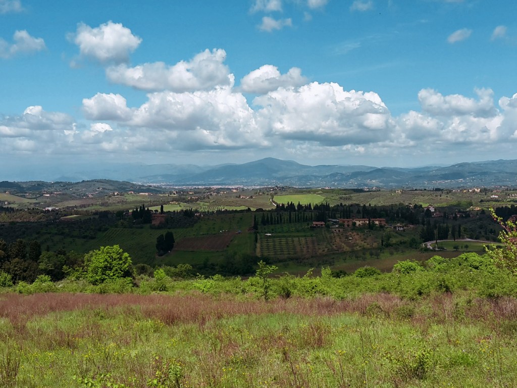
On the southeast section of the Renaissance Ring, our surroundings will be extremely lush (especially if you choose to hike it in late spring or summer) and we’ll gape at some of the most spectacular views of Florence and the plains beyond it. We’ll cross the Chianti, more precisely the Chianti Colli Fiorentini, a subzone assigned to the hills of Florence. Technically, this isn’t the Chianti Classico, where the famous wine was originally developed and classified, but gorgeous just the same. My only caveat is that, unfortunately, the trail is badly maintained as it nears Impruneta. You may want to take a detour by the town of Santa Cristina, but the rest of your hike will be on asphalt.

But first things first! We continue from the train staion of Pontassieve, taking the underground passage to Via Giuseppe Verdi. We turn right and head onto Via di Rosano, which will lead us over the highway, then over the Arno, to the quaint town of Rosano (nowadays a neighborhood of Rignano sull’Arno) cozily nestled at the feet of the Florentine hills. I pause to admire the bell tower of Santa Maria a Rosano, an 8th century monastery and one of the oldest in Italy. We take a right after crossing the bridge and soon we find the signs of the Renaissance Ring, which goes up on Borgo del Monastero towards the convent of Incontro.


The first hour of this hike is a steep uphill, alternating between roads through inhabited areas and rocky terrain through dense woods. These hills are mainly made of sandstone so the gravel covering the path can become very slippery on rainy days (or right after them). We turn around every now and then to enjoy breathtaking views of Montefiesole, Pontassieve and the Apennine mountains beyond. Reaching the Incontro, the convent and the church of San Francesco are worth a brief visit, especially for the amazing viewpoint of the Florentine valley. I know it’s hard to leave such a view behind, but don’t worry – there will be plenty more where we’re going.
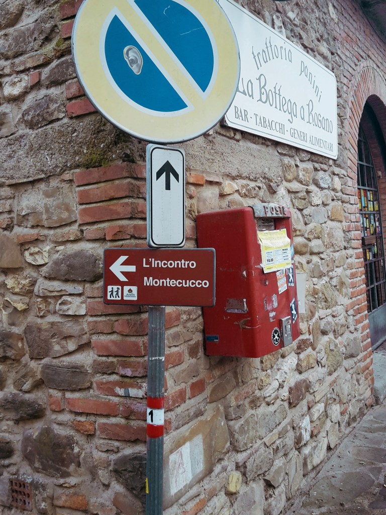
We head down to San Donato in Collina through the tiny communities of Croce dei Frati and Monteccuco. Pay attention to the trail marks as you go through them. From Croce dei Frati, it’s a rocky path uphill. As you reach Montecucco, keep going straight south on the road until you find a narrow downhill path bordering a wire fence. We eventually meet the walls of a private property, which we’ll follow downhill for a few minutes before we approach Via Roma. It’s a short hike on this busy provincial road and the welcoming sight of San Donato in Collina makes up for it.

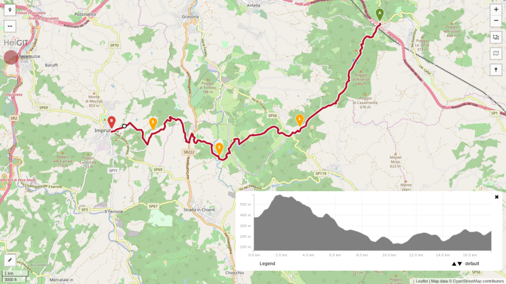
We continue into Via Maremmana swiftly passing through the tiny town, unless you’d like to stop for one of its famous frittelle – a deep fried dough sprinkled with powdered sugar. Not as healthy as an energy bar, but definitely tastier! Don’t eat too many though because we have a steep uphill ahead taking us to the park of Fontesanta, a beautiful wooded area characterized by its Mediterranean vegetation, oak and chestnut trees. We go by a hiking shelter where, during WW2, Italian partisans of the Sinigaglia brigade took cover before embarking on their final battle against Nazi Germany to liberate Florence. Further down the path, we encounter the Sasso Scritto, a solid block of sandstone with ancient inscriptions from the 4th century BC (this one is a copy, the original can be found in the Archeological Museum of Florence).


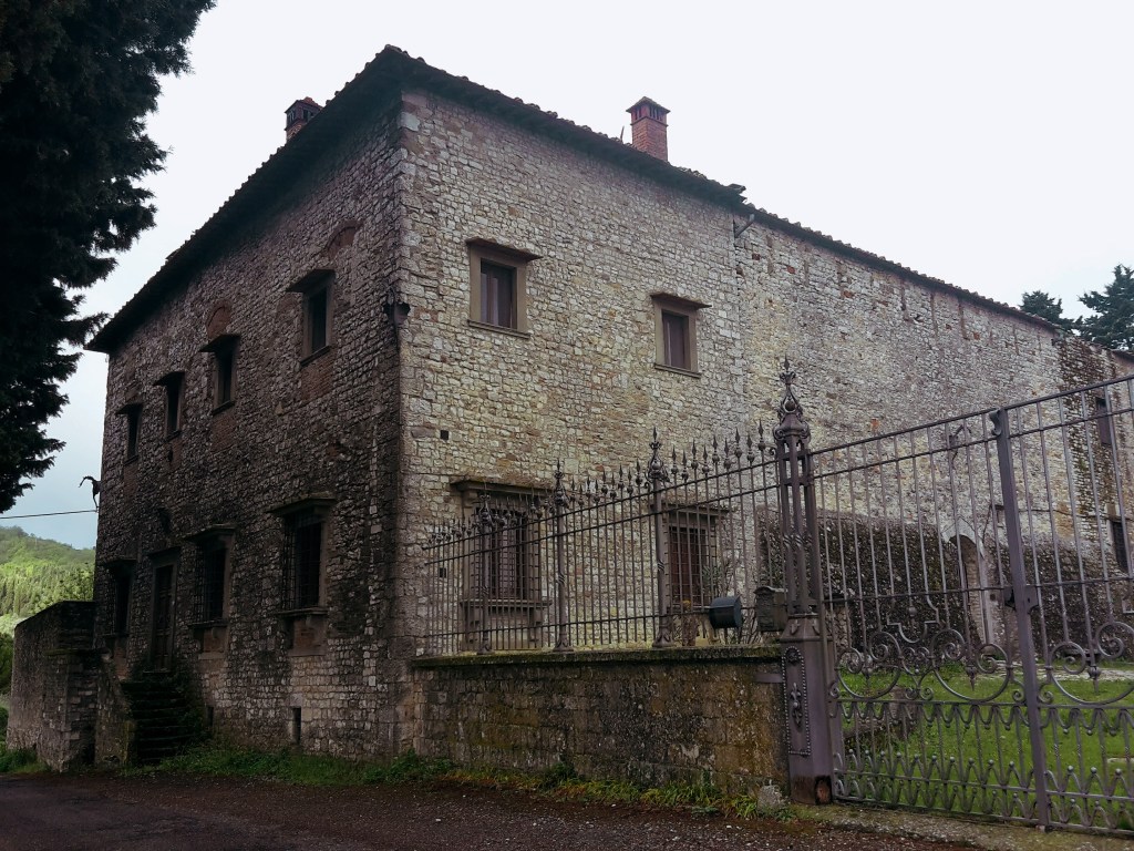
We leave Fontesanta and reach Tizzano, following Via di Castel Ruggero where we find a historical villa, the delightful church of Santo Stefano, and the 16th castle which gives this road its name. Make sure to take a short detour to check out the front of the church and be rewarded with another stunning panorama of the Florentine valley. Soon after we pass the Ruggero castle (now a Chianti winery), we turn left into Via Petigliolo di Strada and head down to cross the bridge over the Ema river. A dog trainer lives by the bridge – although he keeps his dogs in a kennel, it’s always best to be careful as you approach the area.


The trail continues uphill to Via Chiantigiana, a main regional highway that connects Florence and Siena cutting through the Chianti. It’s time to decide if you’re up for some rough hiking, or if you’d rather proceed on asphalt for the final 2.5 miles (4 km) to Impruneta. If an easy walk on asphalt sound appealing at this point, go left on Via Chiantigiana, then right on Via Pian di Pancole. This will take you through Santa Cristina and shortly after you’ll arrive in Impruneta.


If you like a challenge as much as I do, take a right on Via Chiantigiana, then left in Via della Montagnola (just before a gas station) towards Podere Porciana. A closed gate awaits us at the end of this road, but fortunately we can just walk around it. The trail goes left by the building and parking area (you should be facing Impruneta on the hilltop to the west), and down to cross the narrow Grassina stream. This tract is badly kept, we have to trudge through fallen trees, passing by a huge power line before we cross the stream and regain the dirt path uphill to Impruneta. After passing by some private properties on Via delle Terre Bianche, a trail sign we’ll send us into another tortuous and poorly maintained path through the woods. We cross a stream before reaching Via di Fabbiolle and our destination! You can also decide to just ignore the trail sign and continue on Via delle Terre Bianche, turning right on Viale Vittorio Veneto for a faster and more gentle arrival to Impruneta.

Pontassieve – Montecucco – San Donato in Collina
- 2h30
- 7.8 mi (12.5 km)
- Arrive: Pontassieve (by train or bus)
- Depart: San Donato in Collina (by bus)
- How to get there: 30min train ride to Pontassieve from Firenze Santa Maria Novella train station.
San Donato in Collina – Tizzano – Impruneta
- 3h45
- 11 mi (17.7 km)
- Arrive: San Donato in Collina (by bus)
- Depart: Impruneta (by bus)
- How to get there: 45min bus to Montevarchi from Busitalia SITA Nord Autostazione (by Firenze SMN train station).
Thank you for checking out my post! Let me know how I can improve it!
Thank you for the detailed recommendations! I’m here now on vacation from Denver and want to get a hike in…

Happy to learn that my posts were helpful! Enjoy your hike!