After years of living in Tuscany on and off, I’ve had the opportunity to visit Lucca several times. Surrounded by 16th century walls that run for almost 3 miles, this enchanting medieval town is worth exploring all on its own. But, this time I want to discover a completely new area, which will take us towards Monte Pisano following the 19th century aqueduct built by Lorenzo Nottolini.


Nottolini Aqueduct
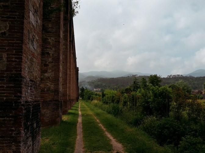
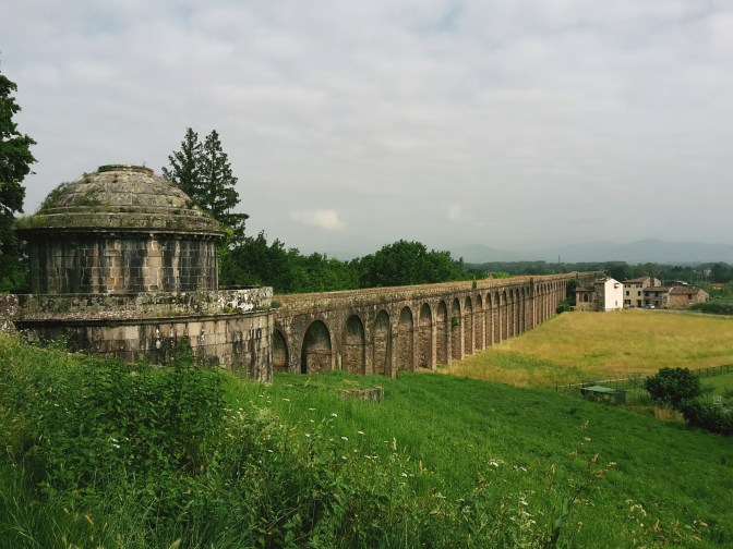
To reach the start of our hike, we exit the train station to the opposite side of the city center and get to Via del Tempietto. The Tempietto di San Concordio, meaning “Little Temple”, is in fact a cistern to collect the water from the aqueduct before a complex pipe system would transport it to Lucca. The aqueduct was built during the rule of Maria Luisa of Spain and it was active for over a century, until when the expansion of the highway connecting Florence to Pisa led to the destruction of several arches and the interruption of the water flow. Luckly for us, a pedestrian overpass allows for a safe cross to the other side of the highway.
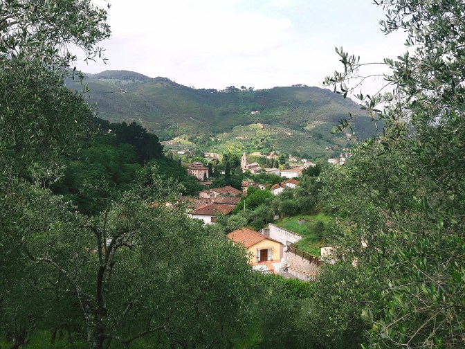
Arriving in Vorno
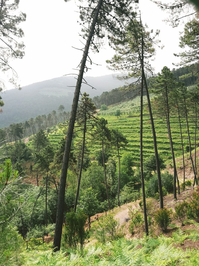
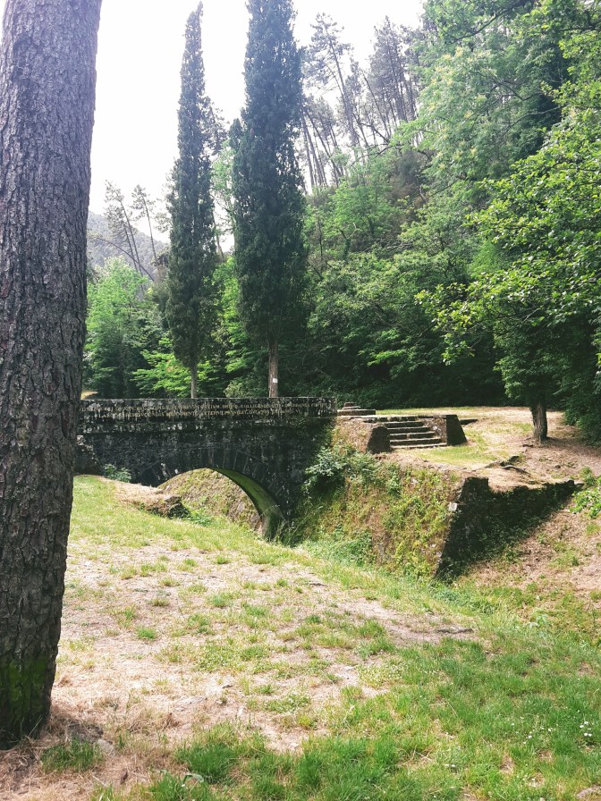
The path follows the arches of the aqueduct for another mile cutting through roads and neighborhoods. Every now and then, locals fill their bottles and gallons with pure water from strategically placed public fountains. Although the historical aqueduct was deactivated, the water from Monte Pisano still flows to Lucca through a modern water supply system. We arrive at the second Tempietto (di Guamo), which would collect the waters coming from further up the mountain. Going around it, the trail breaks into two options leading to Vorno: a direct uphill on the Francigena pilgrimage route, going through the woods and a dirt road that offers a great view of vineyards on the surrounding hills; or following the underground line of the aqueduct to Parole d’Oro, a very interesting site where we can appreaciate the work needed to canalize the waters pouring down the mountain (although it’s mostly dry nowadays). No matter which one you choose, you can always take the other path on the way back to Lucca.

Astronomical observatory 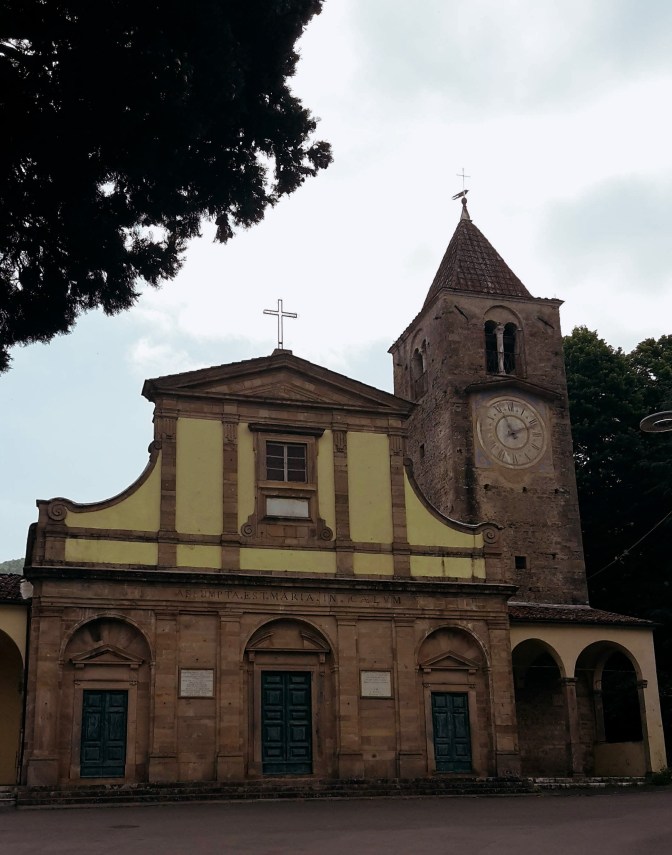
San Pietro
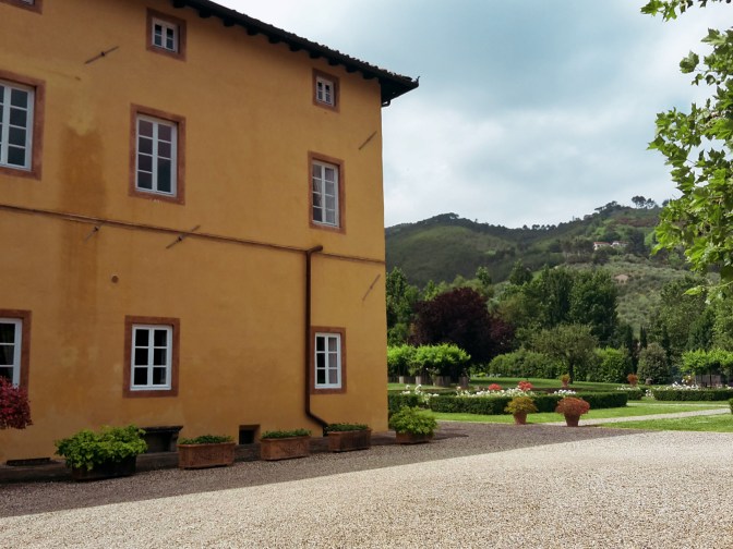
We reach Vorno meandering on Via di Valle while enjoying a lush landscape of chestnut, pine and oak trees covering the surrounding mountains. Vorno is cozily nestled in a green and humid valley underneath Monte Pisano and as we go down towards the center of town, the view of the peaks of Monte Faeta (2,723ft / 830m) and Sant’Allago (2,854ft / 870 m) makes for an impressive welcome. Vorno itself is very charming, you can see that locals take pride of where they live, everything is so clean, houses are well kept with well-tended gardens. Water is everywhere, you can feel the cool breeze coming from Vorno river and there are public fountains where you can refill your water bottles. The elegant church of San Pietro dates back to 867 and you can take a short walk around town to see its several villas turned into rentals for summer vacationers and events.
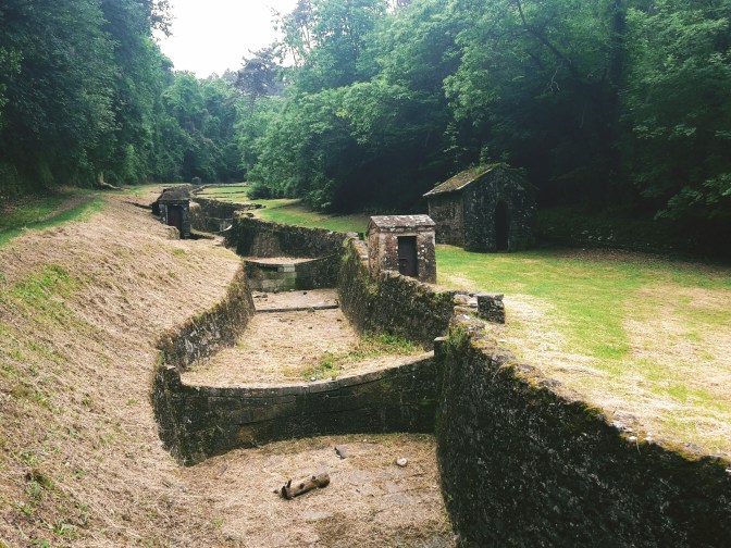
Le Parole D’Oro 
From Vorno, there are many trail options to reach the highest peaks in the area, including Monte Serra (3,009ft / 917m), or continue all the way to Pisa following the Aqueduct Road or the trail dedicated to Matilda of Tuscany, who ruled over Tuscany in the 11th century. This is just an exploratory incursion, but we’ll be back here for more. On the way back to Lucca (or on they way to Vorno, if you go by Parole d’Oro), make sure you walk to the astronomical observatory on top of Via di Valle from where you have a stunning view of Lucca and the Apuan Alps behind it.

View of Lucca – the downside of summer are the hazy days…
I hope you enjoyed reading this post! Come back for more and let me know how I can improve it!

Lucca – Vorno – Lucca
- 4:15h
- 11.1mi (17.9km)
- How to get there: train to Lucca, the walk starts from the south exit of the train station.
Thank you for the detailed recommendations! I’m here now on vacation from Denver and want to get a hike in…

Happy to learn that my posts were helpful! Enjoy your hike!