I’m very excited to explore a hiking trail that long has been in my ‘to do’ list. It’s called Sorgente di Firenze, or SO.F.T., but don’t let this acronym fool you. This isn’t a beginners’ hike since this 115-mile loop around the Mugello takes us through some of the highest Apennine peaks in Tuscany on its eastern tract.
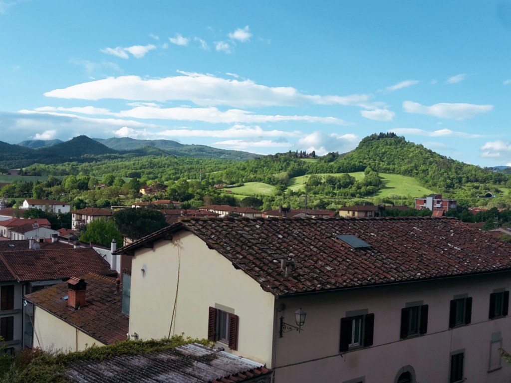

So, I’m starting it easy, from the delightful town of San Piero a Sieve, a half hour north of Florence. We’re in the heart of the Mugello, a romantic countryside with an important history. Here is where the Medici family started its ascension to wealth in the 13th century as wool merchants and their fingerprint is noticeable throughout the hike. Leaving the train station, we head towards the 10th century church of San Pietro. If open, I’d recommend you take a peak inside: it houses a beautiful 16th century baptismal font in glazed terracotta by Giovanni della Robbia. The trail goes up on Via della Compagnia, then onto Via della Fortezza named after the Medici fortress of San Martino. Unfortunately, the fortress is closed to the public, so only take the 5-min detour to check it out if you are interested in seeing its impressive walls. Their perimeter reach 1 mile, with 145,000 square feet of brick, and you can walk all around it.
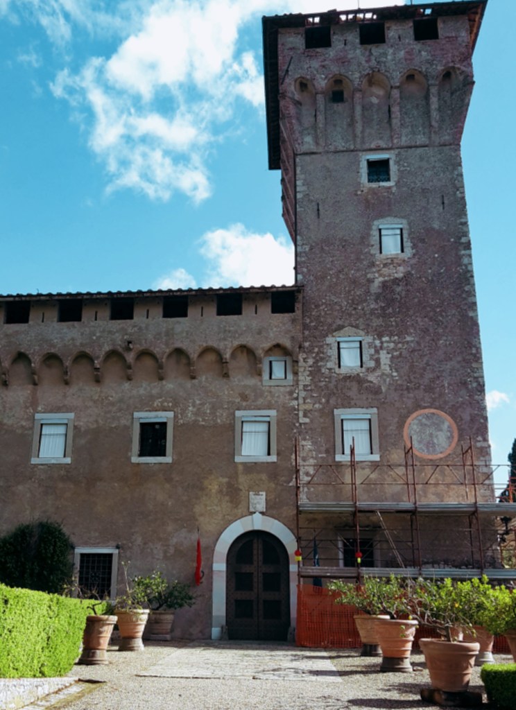


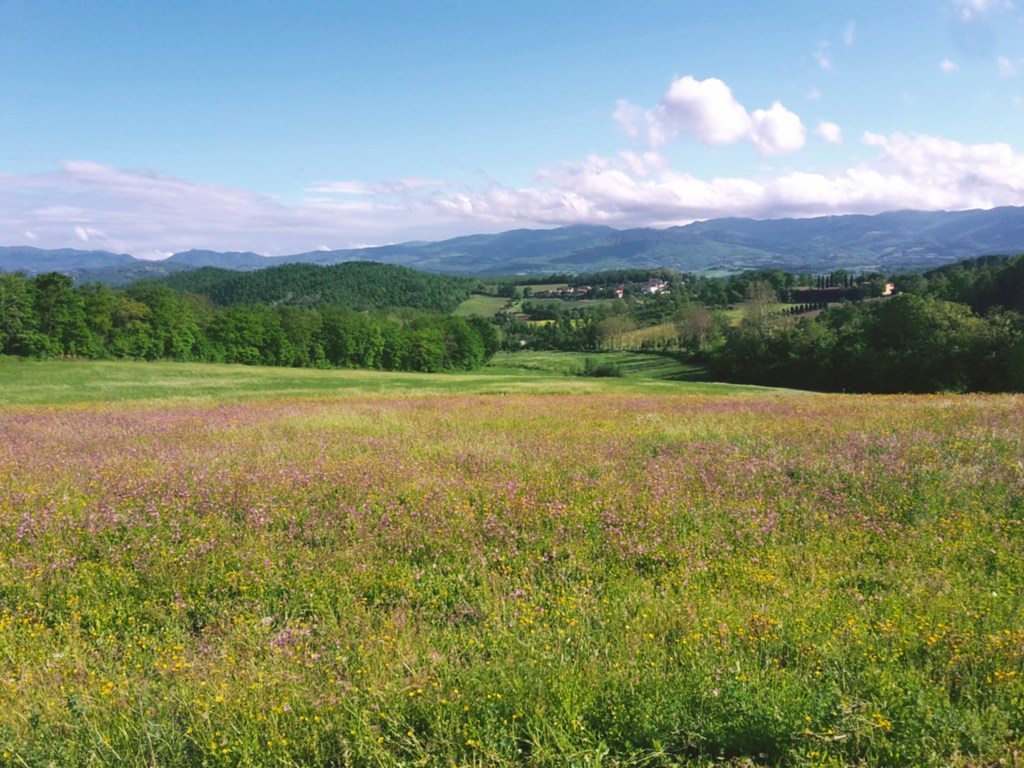
Following the dirt path (or mud, after rain), we move west passing a campsite and soon cross a provincial road to proceed towards Trebbio. We enjoy a gorgeous view of the Apennines and the neighborhood of San Giusto a Fortuna as we go up. An elegant road flanked by cypress trees welcomes us to the Medici villa of Trebbio, one of the first in a series of magnificent properties owned by the famous family. Giovanni dei Bicci lived here in the 14th century, and it was remodeled in the 15th century by Michelozzo by order of Cosimo the Elder. Although listed as a UNESCO World Heritage Site, the villa is privately owned and not open for regular visits. The front gate allows us to peak at the decayed facade, and we can enjoy the rest of the estate, including a delightful chapel backed by a stunning panorama of green hills and the community of Campomigliaio to the south.

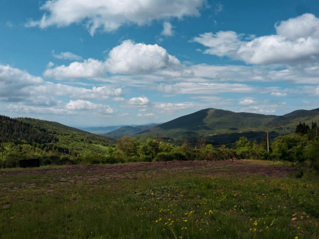
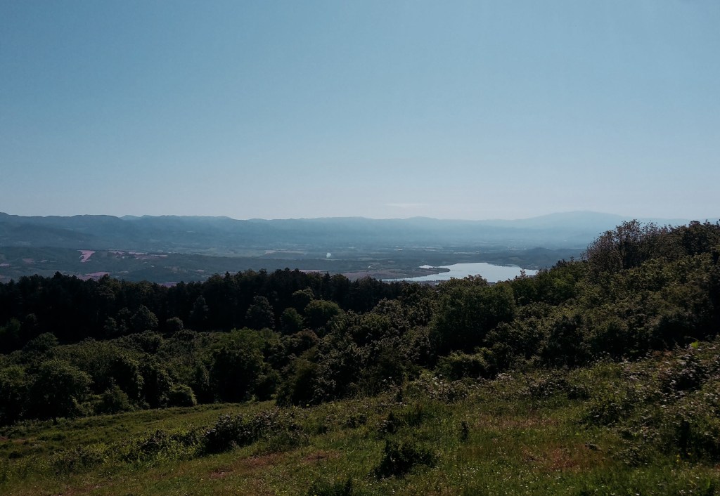
We continue west on a rocky path that will take up to Poggio di Cigoli (1,886 ft / 575 m) before heading down to Croce di Calenzano on a pleasant rural landscape. Along the way, we get a glimpse of the lake of Bilancino and Barberino di Mugello on its shores but the numerous oak trees populating the hill don’t allow for an open view of this man-made lake and the surrounding Apennines. Arriving in sleepy Croce di Calenzano, we follow north on Via di Barberino and cross it to find path CAI n.44 in Via di Montemaggiore. Prepare for a good uphill hike ahead until we reach Monte Maggiore, the highest point of the Calvana mountains at 3,005 ft (916 m).
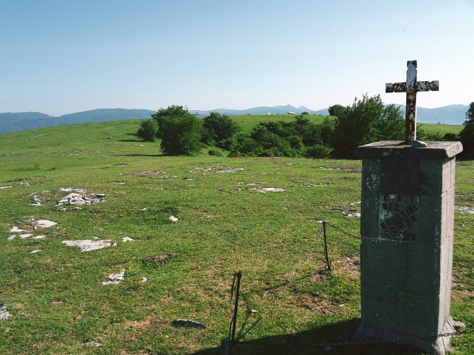
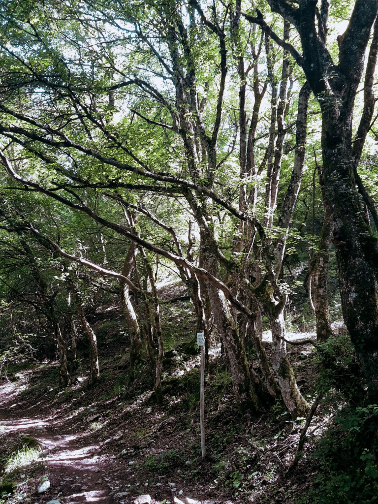
The initial uphill is on the road, Via Montemaggiore, before with find the trail post sending us on a pleasant wooded trail. The Calvana preserve is home of boar, ferret, marten and wolf, although what I often spot is the capriolo, a type of deer very common in Tuscany. After passing the shelter, we soon leave the pine and oak woods into a clearing. Note the trail mark on a flat stone on the grass that points to the right towards the pines, which we quickly cross to reach a vast grassland. We continue uphill to soon spot a cross that marks the top of Monte Maggiore.


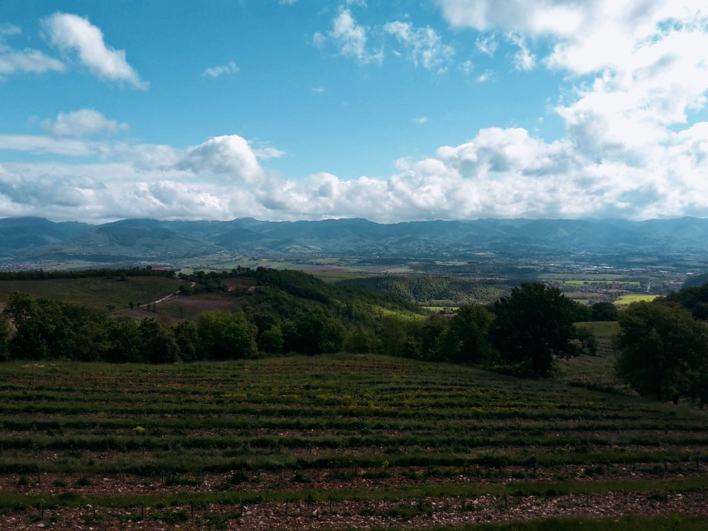
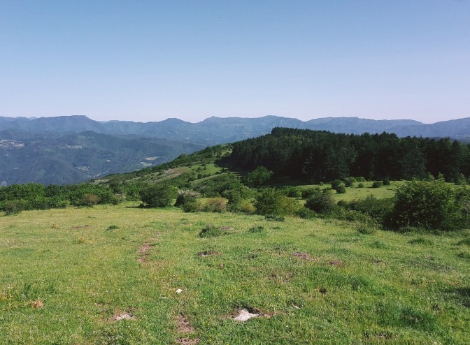
Often you’ll encounter Calvanina cattle and wild horses grazing in the area. They keep the grass level under control, but on the other hand, horseflies abound in the hot months. Unless you cover yourself with DEET, it becomes very difficult to spend quality time up here. We can enjoy fantastic views of the Mugello, Bilancino Lake and the Apennines to the east; the town of Vaiano and the Pistoiese mountains to the west; and the Florentine valley to the south.
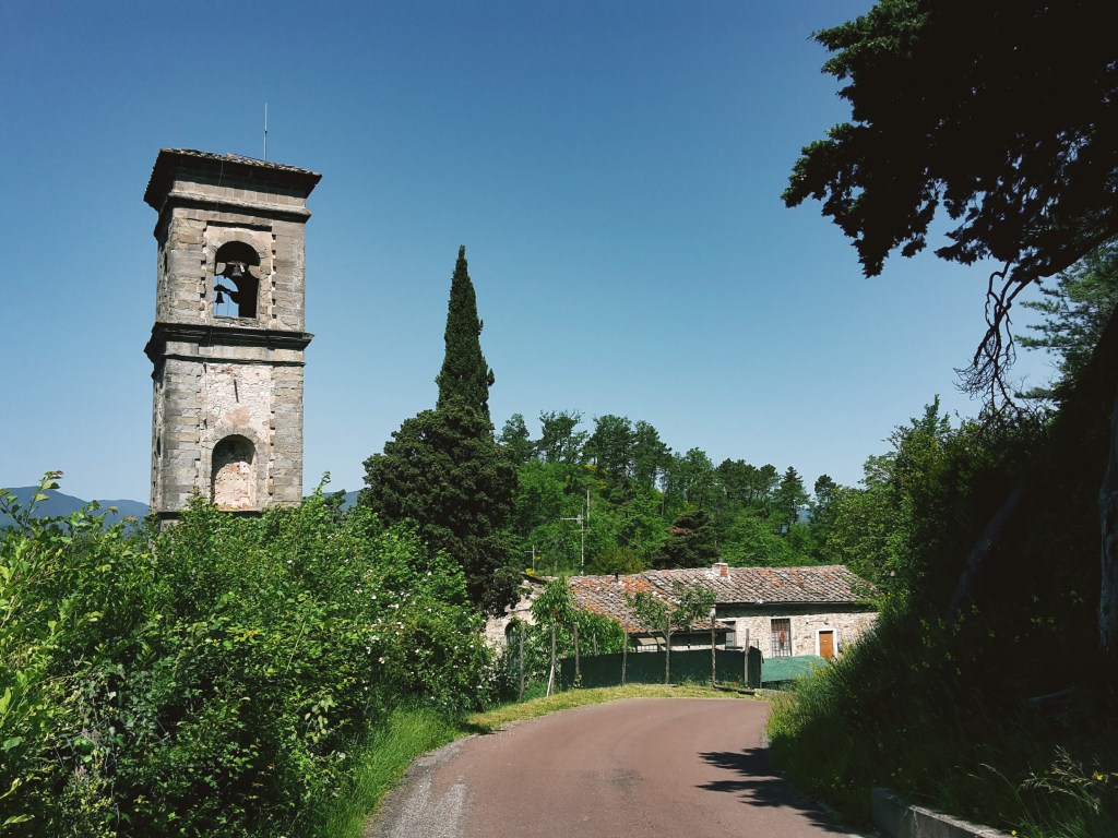
We head north towards another wooded area. Path CAI n. 20 is very wide and shaded as we progress to Montecuccoli, which makes for a very enjoyable hike. This is also part of the Road of the Silk and Wool, a 5-day trail connecting Bologna to Prato through the Apennines. The more we hike around here, the more there is to discover. In Montecuccoli, a 5-minute detour takes us to the charming church of San Michele Arcangelo, a real treat if open. It’s another 6.2 miles of little variation in altitude until we approach Le Soda.
Although the SO.F.T. trail continues to Passo della Futa and beyond, I had enough hiking for a day and I’m ready to head down to the train station in Vernio. We leave path CAI n. 20 to a fast and steep downhill on CAI n.60, passing by a private property (and goats!) before we reach the neighborhood of San Quirico. If you still have energy on the way to the train station, you can take some time to wander around this lovely town, crossed by the Bisenzio river (the same one that we find in Prato and along the Renaissance Road) and its tributary Fiumenta.

Thank you for reading! Please share your comments!

S. Piero a Sieve – Monte Maggiore – Vernio
- 8h15min
- 21.4mi (34.5km)
- Arrive: San Piero a Sieve (by train)
- Depart: Vernio (by train)
- How to get there: 30-min train ride from Santa Maria Novella train station.
