As spring begins, I become more adventurous and decide to tackle the trail called Anello del Renascimento, or the Renaissance Ring. Using Florence and its Duomo as the central point, the trail loops around 105 mi (170 km) connecting several historical towns and sites through Monte Morello, the Mugello, Valdisieve, the Chianti and more. It could be completed on 4-5 long hiking days. Better yet, 6-7 days if you’d like a more paced experience, giving plenty of time to gaze at the beautiful scenery and explore the places you’ll encounter along the way. Another option, which was more suited for me because I live here, is to take day trips from Florence and discover it bit by bit.
I chose the town of Signa as the starting point for a couple of reasons: it’s an easy train ride (20 mins) from Santa Maria Novella station in Florence and I thought I would start nice and easy. We had a mild winter and hadn’t seen rain in a while, and it wasn’t full summer yet. So, less bugs, not as hot, a great time to hike across the plain of the Bisenzio river, passing Campi Bisenzio on the way to Calenzano.
View from Signa train station 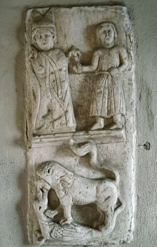
Detail of medieval bas-relief in the cloisters of Signa’s St. John the Baptist
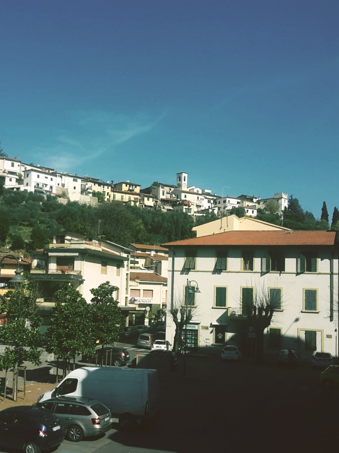
Coming out of the train station, we see the old town perched on the hill crowned by the bell tower of the church of Santa Maria in Castello. Small in size and in population (almost 20,000 people), rich in history: Signa is first documented back in the days of the longobard margraves, during the Early Middle Ages. But, not far from we find an etruscan necropolis from the 8th century BC in the Montalbano hills. For centuries, this was the main route between Pisa and Florence, making Signa into an extremely coveted position. Closer to our days, the town became known for its local handcraft, especially terracotta and straw weaving.
The Renaissance Ring takes us right through town – from Via Roma up onto the steps of Via del Castello into Via Mura Castellane then Via dell’Orologio. Passing by Piazza Claudio Bigagli and 10th century Santa Maria in Castello, we continue to Via Dante Alighieri and head down to Piazza Cavour and 7th-century church of St. John the Baptist. By the town hall, we head down the local park to Via Roma and then take Via dei Renai until we cross the bridge over the Bisenzio.
We are at the entrance of the Renai park. We don’t enter the park, instead, on our left the trail follows the river towards San Mauro. Unfortunately, this stretch was flooded several winters ago and the path destroyed. After about a half mile flanked by tall reed, the path disappears into an open field, someone’s property. Crossing it during winter or early spring should be an issue, since the land is still being worked on, but later in the year you may find the owner not pleased about people trudging through his land. The alternative would be, before crossing the Bisenzio, to take a left in Viale dell’Arte della Paglia and then right into Via Argine Strada, and walk on the busy road until San Mauro. I rather deal with the farmer, although I didn’t meet him this time.
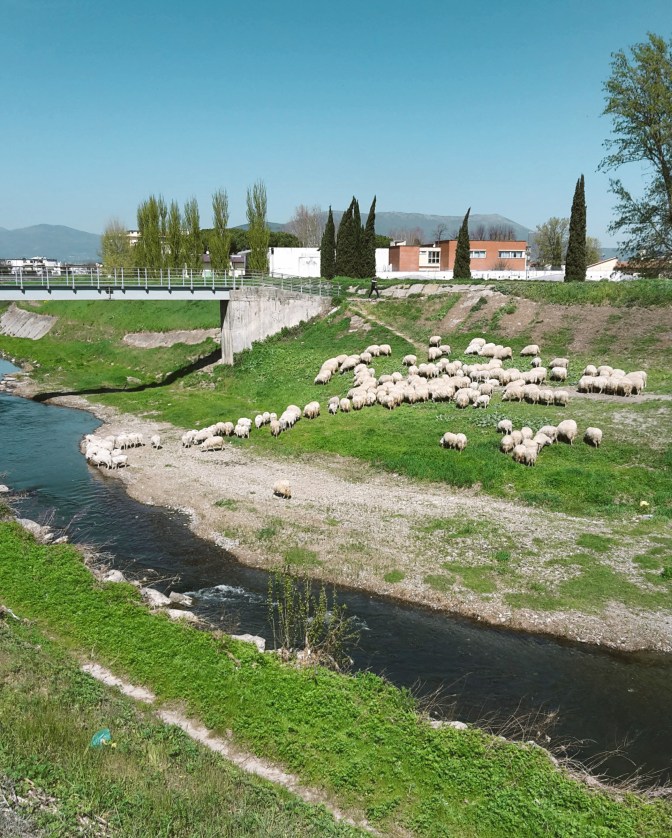
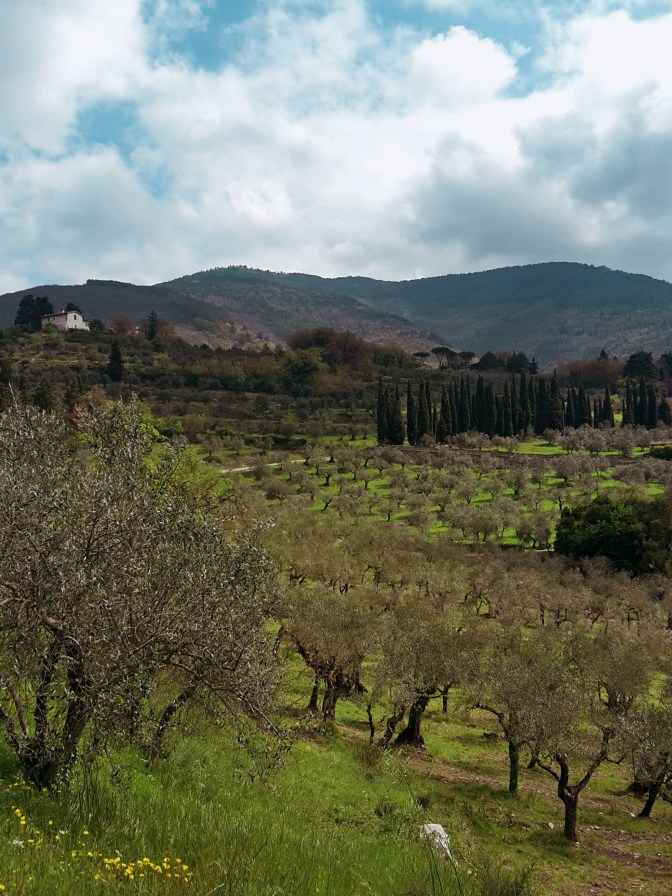
OK, the trail between Signa and San Mauro is uninspiring. Vegetation is overgrown and the low thick bush makes for an unpleasant walk. But, hey! We are in Tuscany and this is the Renaissance Ring! We finish this section very quickly, and soon things improve considerably on the way to Campi Bisenzio. We cross to the other bank, and the river walk becomes what I expected. We can finally enjoy the Bisenzio, a tame river, one of the tributaries of the Arno, where blue herons and eagrets feed, giant wels catfish jump in the air, and local Tuscans sunbathe on the banks while their dogs frolic in its waters. Every once in while, turn around for a beautiful sight of Signa, on the now distant hills.
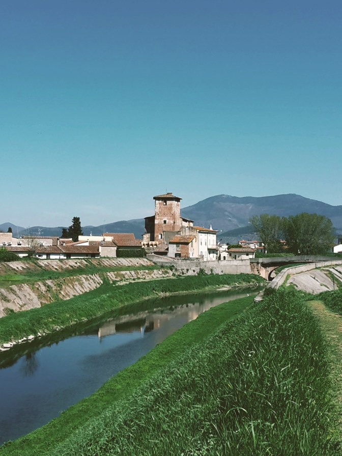
Sight of Strozzi Fortress as we approach Campi Bisenzio 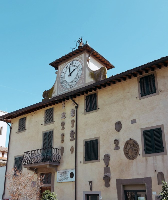
The town hall of Campi Bisenzio
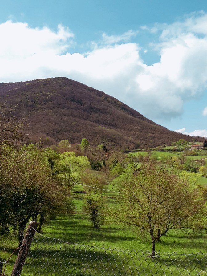
The plains between Florence and Pistoia make an important industrial zone in Tuscany, full of warehouses, factories and connecting highways. It’s surprising how quiet and peaceful the hike along the Bisenzio is. It feels like a walk in the countryside. Occasionally, we see small land owners planting their grain and tending their gardens and greenhouses. Ahead, the ranges of the Calvana and Monte Morello make for a stimulating background. The Renassaince Ring will eventually take us up to the park of Monte Morello, once we pass Calenzano.
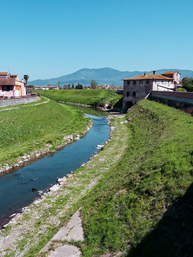
Arriving in Campi Bisenzio, we first notice the imposing Strozzi Fortress, a 14th-century castle that guards the river and is currently under restoration. Practically a suburb of Florence, the town itself doesn’t offer much more, and we can swiftly make our way to Calenzano. After crossing the bridge to the other bank, we continue to follow the river on a very scenic path. By the neighborhood of Capalle, we’ll cross our last bridge of the day and say our goodbye to the faithful Bisenzio who guided us for the past 6.5 mi (10.5 km). We take Via di San Quirico to the tiny and quaint center, then Via di Pantano to meet the Marinella stream. Don’t cross the bridge! Go right towards the highway and the underpass that will bring us to the commercial area of I Gigli – shopping mall, hypermarket, cinemas…the whole shebang. No need to slow down around here, we soon arrive at train station of Calenzano to end this leg of the hike.
Villa Peragallo – servants quarters 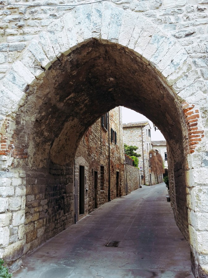
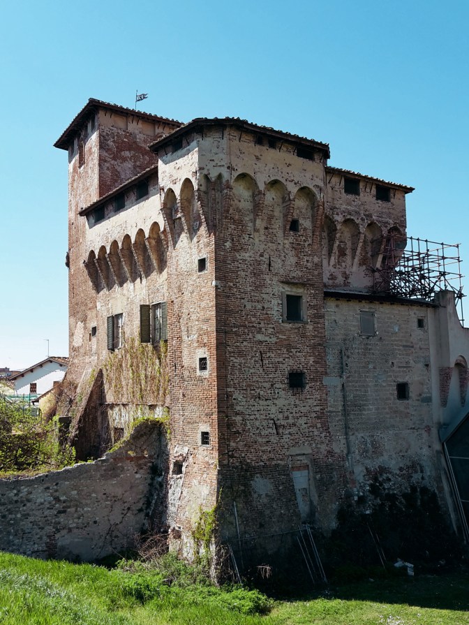
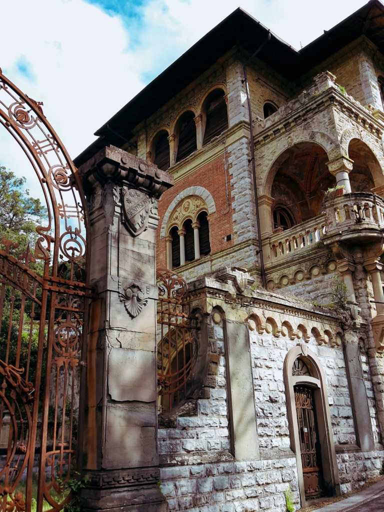
Entrance gate of Calenzano 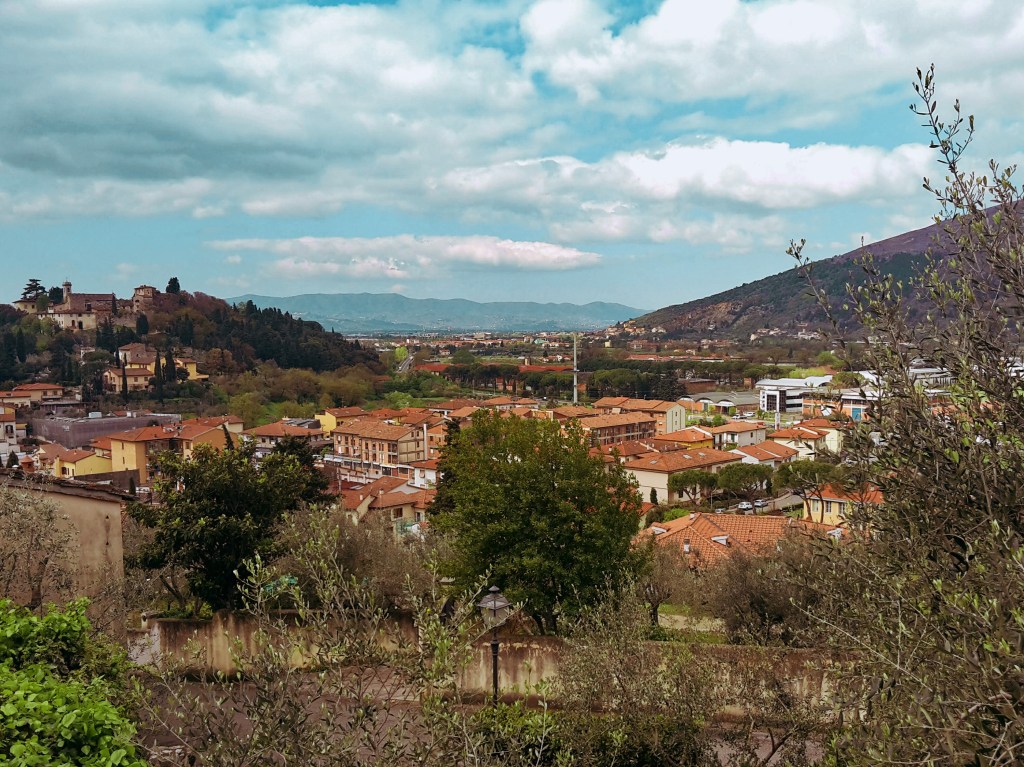
Calenzano perched on the left hill and the Montalbano mountains in the distance
Like in most Tuscan towns, the surroundings of the Calenzano train station are pretty drab. But let’s not get discouraged, after a few minutes walking on Via del Molino, we cross a bridge over the Marina stream and continue gently uphill on Via del Castello. Things improve fast, as we pass by the 19th century Villa Peragallo and soon reach the entrance gate of the Castle of Calenzano. The views from Piazza San Niccolò are worth a pause to appreciate what we’ve just accomplished: on the horizon, Signa appears as a hazy cluster lodged at the feet of Montalbano. I welcome the sight of the Calvana and its main peaks – Retaia, Cocolla and Cantagrilli. Although they aren’t in the program today, I very much enjoy hiking up there.
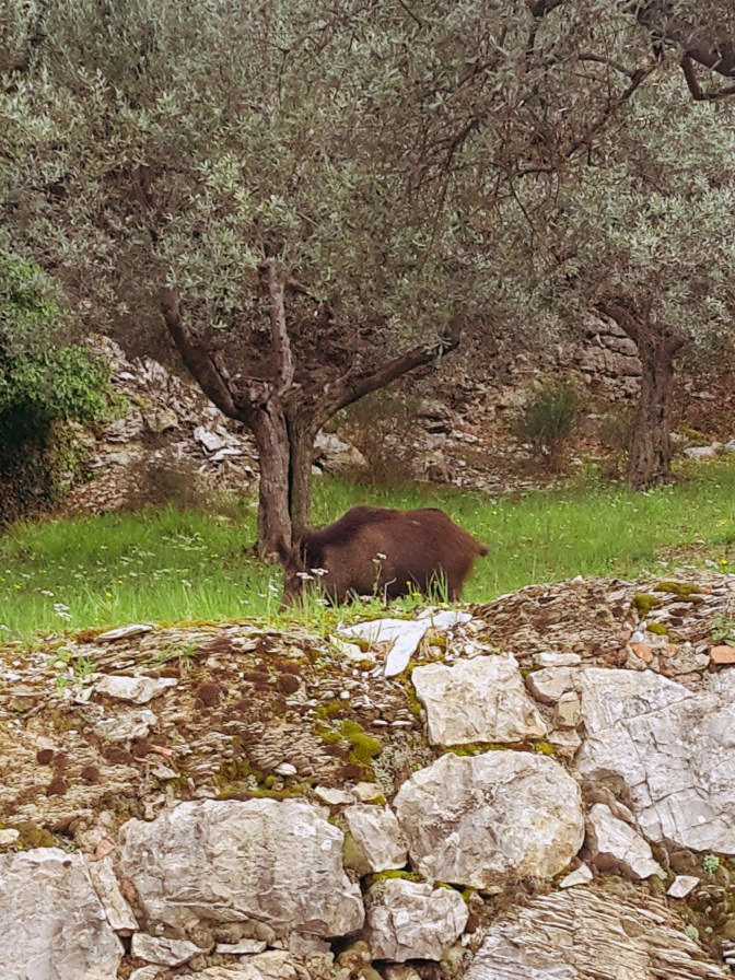
Plenty of wild boars in the area – it was more surprised to see me… 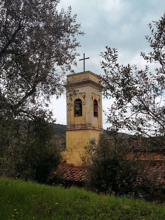
Bell tower of San Rufignano a Sommaia 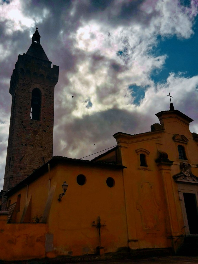
San Donato in Calenzano
Next stop is the church of San Donato, which has been around since the 9th century, on the adjacent hill. We continue east on Via di San Donato, passing under the highway to Via delle Vigne and the 11th century church of San Rufignano a Sommaia. The trail then turns westward by a house with tiny Medici crest, and shortly we pass a bar that keeps cars from going further into the park of Monte Morello. We continue on a forest road that contours the slopes of Monte Morello offering magnificent views of the surrounding countryside until we reach the church of San Giusto a Gualdo, which has been transformed into a shelter for hikers.
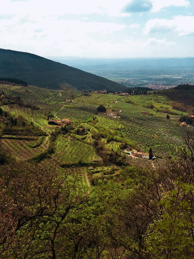
View from Monte Morello park 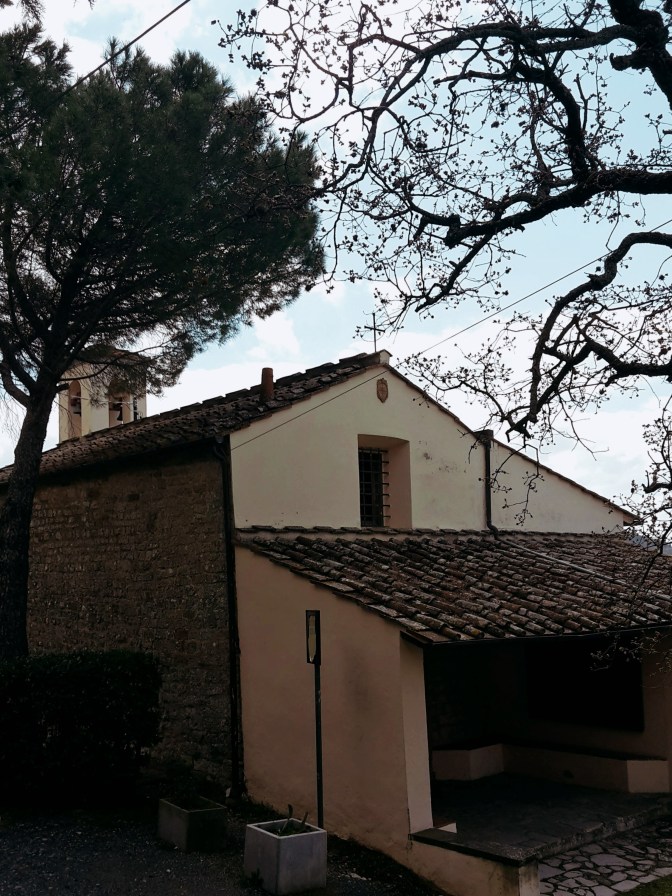
San Giusto a Gualdo: hiking shelter
After the shelter, the trail follows the road for a short while before we take path CAI n.11 by the Vecciolino spring. Now, pay attention as you arrive at an inhabited area with a bee farm. The Renaissance Ring continues through here but this area also houses an archery range. There are plenty of signs, ribbons, painted arrows and foot trails to take you to the several practicing targets. If you start seeing animal props like bears, cows and deer (it’s a bit surreal but makes total sense, in best Italian fashion), you already lost the trail. The path CAI n.11 takes us through woods of pine, cypress, oak and fir trees to the Sella delle Colline, a crossing of several trails. From here, the adventurous soul could take a detour to reach the highest peaks of the range – Poggio Casaccia (3,022 ft / 921 m), Poggio Cornacchiaccia (2,927 ft / 892 m) and Poggio all’Aia (3,064 ft /934 m). This deviation would add at least another 1h30 to the hike and definetly reward you with wonderful views of the surrounding area. To continue on the Renaissance Ring, we take CAI n.7 for a quick descent to Pescina contouring Poggio Trini.
Poggio Capannelle 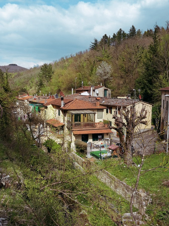
The secluded town of Paterno
We leave the woods of Monte Morello to find Via di Pescina, which will take us to Paterno, a secluded suburb of Vaglia. From here on, it’s an easy and bland hike on a not too busy road until we reach the more trafficked road of Via Bolognese that connects Florence and Bologna. Thankfully, we don’t spend much time on it and soon arrive in Vaglia to close the second leg of the trail.
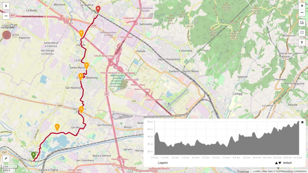
Signa – Campi Bisenzio – Calenzano
- 3h
- 8.7 mi (14 km)
- Depart: Signa train station
- Arrive: Calenzano train station
- How to get there: 20-30 min train ride each way from Santa Maria Novella station
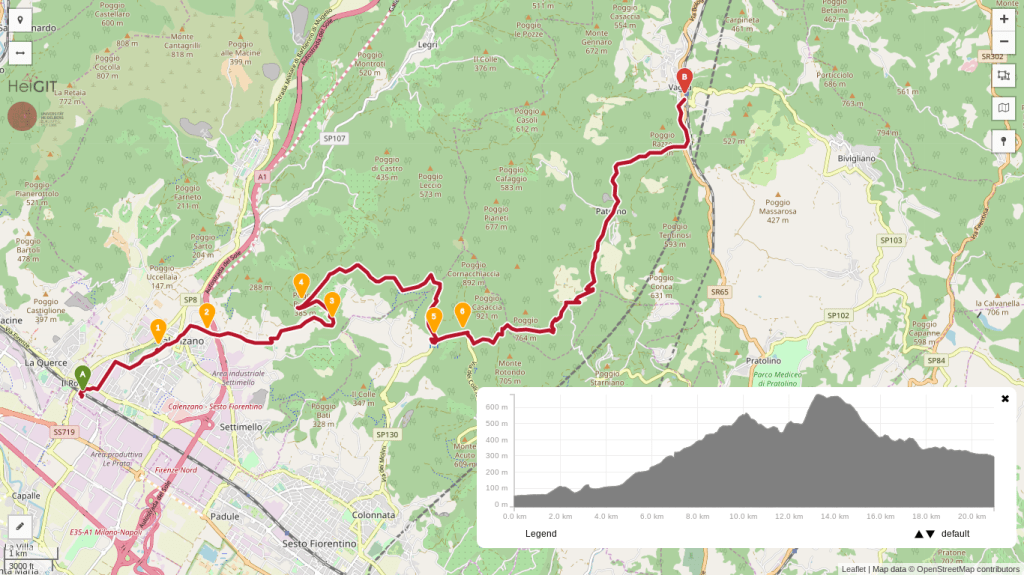
Calenzano – Monte Morello – Vaglia
- 5h
- 13.1 mi (21.1 km)
- Depart: Calenzano train station
- Arrive: Vaglia train station
- How to get there: 30 min train ride each way from Santa Maria Novella station
I hope you enjoyed this post! Please write your comments so that the next one becomes even better!
Thank you for the detailed recommendations! I’m here now on vacation from Denver and want to get a hike in…

Happy to learn that my posts were helpful! Enjoy your hike!