Category: Florence & Oltrarno Walks

Walks you can start on foot or by city bus from central Florence, Italy: the Oltrarno hills of Bellosguardo, Arcetri and Pian dei Giullari, and the Arno river banks. Quiet views of the Duomo, away from the crowds.

  • Arno River Walk in Florence: Rovezzano and Albereta

    Arno River Walk in Florence: Rovezzano and Albereta

    Another regular walk of mine goes along the Arno river towards the neighborhood of Rovezzano, then crossing the river to the Albereta park and back to Ponte San Niccolò. This is a pleasant hike during partially cloudy days, as sunny and hot weather may become challenging due to the lack of shade by the river banks. My favorite characteristic about this path is seeing Florence from underneath, by the banks of the Arno. While some tourists take a peculiar gondola ride by Ponte Vecchio in the summer months, I rather be far from the crowds and wander in a less-explored part of the city.

    We start at Ponte San Niccolò, on the side of Lungarno del Tempio. Right at the entrance of the public park there is a path leading down to the river bank, passing the small dog park. It’s a great relief from the traffic noise coming from the street above. It immediately feels like we’re entering into a different Florence. Heading east, we soon arrive by the confluence of the meek Affrico river and the Arno. The Affrico was tamed a long time ago by the first Roman settlers, nowadays we don’t even notice this tributary walking around the city as it moves underground. Continuing along the grassy banks, we reach the Ponte Giovanni da Verrazzano, a bridge named after the famous 16th century Florentine navigator.

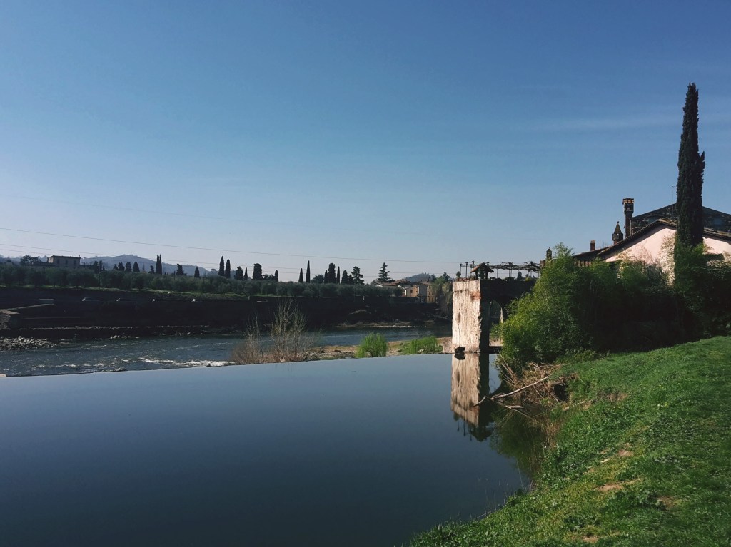
    We pass by 14th century Villa della Casaccia, famous for having accommodated painters and poets in the 1800s. Ahead, the circus tent-shaped roof of TuscanyHall, one of the main concert venues of Florence, makes for an unusual sight. Shortly after, we cross under the Varlungo bridge to reach Rovezzano on Via della Funga. We spot a complex of buildings that were once the watermill and weir of San Michele a Rovezzano, a nice area to relax and enjoy the Arno up close. In the summer, I often spot Florentines sunbathing in this very scenic area. The weir was built to prevent the devastating floods of the Arno, the latest one destroyed plenty of lives and precious works of art in 1966. Before then, ferries would transport passengers across the river at this place, thus the area being named Nave a (boat to) Rovezzano.

    From here there are a couple of side options before heading back into town. Option one: keep following the path along the river all the way to the neighborhood of San Jacopo al Girone to enjoy a few more scenic views of the Arno. Also, you can visit the Florence War Cemetery for Commonwealth soldiers who died to recapture Florence during WW2. The second option takes us on a loop visit to Rovezzano: we leave the dirt path turning left on Via delle Mulina di Sant’Andrea and continue towards the park of Villa Favard after we pass the recently restored church of Sant’Andrea. Villa Favard today is a music conservatory, but this historical building has been redesigned by famous architects in the past: Baccio d’Agnolo in the 1500s and Giuseppe Poggi in the 1800s. It’s a lovely park to be enjoyed on a sunny afternoon while listening to talented musicians practice their art.

    We depart towards Via della Nave a Rovezzano to return to the banks of the Arno and follow Via della Funga back to the bridge of Varlungo. We will use it to cross the river and reach the Albereta park. The poplar trees that give name to this park provide a nice shade for the next mile, as we pass a small model of the Duomo and the Anconella acqueduct, Florence’s water treatment plant. After crossing the roundabout by Ponte Giovanni da Verrazzano, we proceed along the cycling path on Lungarno Francesco Ferrucci to soon find Ponte San Niccolò for the end of our walk.

    I hope you enjoyed this post! Looking forward to your comments!
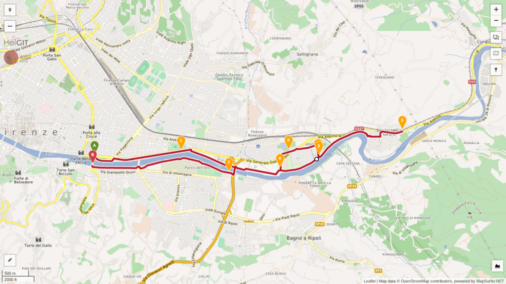
    Trail map of the Arno riverside walk

    Ponte San Niccolò – Rovezzano – Albereta

    • 2:15h (3:45h with Il Girone and Florence War Cemetery)
    • 6 mi (9.5 km) / 8.2 mi (13.2 km)
    • Getting there: the walk starts and ends on the outskirts of the historical center, a short walk from Santa Croce and the Duomo. But, you can also take bus n. 23 (stops Piazza Piave or Zecca Vecchia Cavalleggeri) or C4 (stop Serristori Piazza Poggi) and get out by Ponte San Niccolò.

    Bus and train timetables in Tuscany change often. If you find a line has changed or a stop has moved, please let other hikers know in the comments below!

    Related hikes: Bellosguardo walk · Arcetri hills · Monte Senario from Campo di Marte

    Do you have a favorite riverside walk in Florence? Tell me in the comments.
  • Arcetri and Pian dei Giullari: Florence Hill Walk

    Arcetri and Pian dei Giullari: Florence Hill Walk

    It’s Sunday in Florence. This is a fantastic city and, of course, I’m not the only one to realize it. On a beautiful day like today, thousands of people from all over the countryside and beyond usually come into town for a stroll in its charming streets, like Via dei Tornabuoni, Via del Corso and Via di Calzaiuoli. As the tourist season intensifies, we add tens of thousands people more to our very compact historical center. If you enjoy crowds and people watching, this is the place to be. I don’t, so I usually avoid the center of Florence on Sundays. For another quiet loop nearby, see my Bellosguardo walk.

    Today is another gorgeous winter day though. It’s a waste to spend it inside. So, how can we enjoy Florence without being in the middle of the hustle and bustle? Well, I think I know just the right path for us to walk on. From Porta Romana, the imposing 14th century city gate that controled passage to and from Rome, we follow Via di Poggio Imperiale on a path that shifts from gravel to grass back to gravel as it ascends above the road, giving us the impression of walking on the city ramparts. We pass several elegant villas and townhouses before arriving at Villa di Poggio Imperiale, a Medici residence back in the day that is now a public school. Stone lions guard the sides of the road and the villa dominates the scene at the top of the hill.

    Old stone house with shuttered windows on a narrow lane

    We go left and then turn right into Via Suor Maria Celeste, named after Galileo’s daughter (born Virginia Galilei) who lived in a convent on this street. We are walking in the neighborhood of Arcetri, which is tightly related to Galileo. The observatory from where he made some of his astronomical discoveries is here, still in use as part of the University of Florence. You will notice its white dome many times as we walk around these hills.

    The views of the countryside around Galluzzo soon reveals itself, Renaissance style villas occasionally appearing on each side of the narrow road. Around here, no cars, no people, just chirping sparrows and fluttering turtle doves. We go by Villa Le Piazzole and turn left into Via di San Matteo in Arcetri, flanked by low stone walls and olive trees. On lucky days, it’s possible to enjoy a wonderful panorama and learn some Tuscan geography: Monte Morello, towers above Florence at 3,065 ft (934 m); moving west, the Calvana, also reaches 3,000 ft (915 m) above Prato; across from them, on our side of the Arno river, we can see all the extension of the Montalbano, which peaks at 2,077 ft (633 m) and closes the valley in the distance where it encounters the Appenines by Pistoia and Serravalle Pistoiese. Beyond these geographical features, the high Apennines and the Apuan Alps can be seen on exceptionally clear days.

    Almond tree in white spring blossom

    Continuing the hike, it is time to admire the picturesque Tuscan hills towards Impruneta, with their olive groves (silvery green year round), vineyards (vivid green in the summer), umbrella pines, cypress, almond trees (beautiful white bloom around February/March) and rosemary bushes. We soon pass the church of San Matteo in Arcetri and the convent of Sister Maria Celeste to arrive at a junction with Via del Pian dei Giullari.

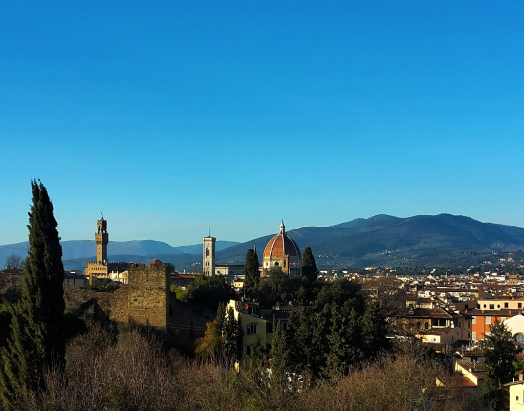
    We turn right, hiking along this charming street of isolated villas with some of the most beautiful panoramas over Florence and the hills of Fiesole. We head uphill to reach the romanesque church of Santa Margherita a Montici. The valley of the Ema river opens up on our right, which unfortunately also brings loud highway traffic noise since one of the main national roads connecting the north and south of Italy cuts through it. But it doesn’t take the beauty away, especially when we are further down. The Ema valley disappears, substitued by a breathtaking view of Florence, the Duomo and the church of Santa Croce, the soccer stadium, and the neighborhoods of Campo di Marte and Coverciano, with Fiesole peacefully watching over them.

    We continue downhill and turn left in Via Benedetto Fortini, soon arriving in the neighborhood of Gavinana, where we find 19th century townhouses in Victorian style. We could easily head to the center of Florence from here, following the Arno downstream. But we want to stay in Oltrarno and arrive at the most scenic postcard of the city: Piazzale Michelangiolo. Yes, it will be busy but it’s worth it. After all, we spent most of the walk away from it all.

    View over the valley and hills from Santa Margherita a Montici
    Beautiful view of the Ema river valley

    So, let’s cross Viale Michelangiolo into Via dei Bastioni and turn left on Via di San Miniato al Monte, a steep uphill that coasts Florence’s most panoramic campsite. It will help us avoid the traffic of the other streets. At the top, we rejoin Viale Michelangiolo, turning left to soon arrive at the awesome Piazzale designed by Giuseppe Poggi in the late 19th century. This was one of the many projects he developed in his quest to turn Florence into a city suitable to be capital of the newly unified Kingdom of Italy and house the royal family of Savoy. His beautification works are controversial in Florence, but I’ll say he hit a homerun with Piazzale Michelangiolo. The view is amazing – any time of the day, any season of the year – and worth a thousand words. Just enjoy it.

    You thought our day was over? This awesome panorama just reinvigorated me, so we will head for the last leg of our walk through charming Florentine streets. First, a detour uphill to visit my favorite church in Florence: San Miniato al Monte. This 11th century basilica in romanesque style has a beautiful marble facade and it was erected in the site where the martyr St. Miniato died. As the story goes, the saint miraculously walked uphill with his head under his arm after a roman soldier beheaded him by the Arno river. Those were the days! With our heads firmly attached to our neck, we can better enjoy another gorgeous view of Florence before continuing on Via delle Porte Sante, and then turning right on Via dell’Erta Canina after we cross the road.

    Narrow street with ochre houses

    I love this street. Via dell’Erta Canina makes me feel like I’m walking in old Florence, the bright yellow townhouses paving the way to a very exclusive sight of Santa Maria del Fiore and the Duomo. My advice: take your time on the way down and savour the view.

    At the very bottom, we arrive at Porta San Miniato and turn left on Via di Belvedere, the last and rather steep uphill of the day. We skirt the medieval city walls, which still stand on this side of the Arno, until we reach Porta San Giorgio and the Belvedere fort at the top of the Boboli hill. Commissioned to Buontalenti by Ferdinando I de’ Medici, the 16th century fortress is strategically located, overlooking Florence and the surrounding countryside and, of course, gifting current visitors with more spectacular views of the city.

    Via di San Leonardo, another picturesque street, will take us by olive groves and villas of noble Florentine families, like the Vecchietti, and the quaint church of San Leonardo in Arcetri. We turn on Via Schiapparelli, then right on Viale Machiavelli, which will bring us all the way down the Boboli hill back to Porta Romana closing this great panoramic loop.

    Trail map of the Pian dei Giullari loop with an elevation profile

    Poggio Imperiale – Pian dei Giullari – Arcetri

    • 3h30
    • 7.7mi (12.4km)
    • Depart/Arrive: Porta Romana
    • How to get here: Bus n. 11 (Autolinee Toscane) from Piazza Santa Maria Novella

    Bus and train timetables in Tuscany change often. If you find a line has changed or a stop has moved, please let other hikers know in the comments below!

    Thank you for reading! Let me know what you think of this post and help me improve this blog.

    Related hikes: Bellosguardo walk · Arno river walk · Galluzzo and Impruneta

    Which view of Florence do you like best, from Boboli, Arcetri or somewhere else? Tell me in the comments.

  • Florence Off the Beaten Path: Bellosguardo Hill Walk

    Florence Off the Beaten Path: Bellosguardo Hill Walk

    It’s winter. There was a time when the cold and gray days wouldn’t affect me as much. As I age, I feel that my Brazilian blood is manifesting itself preferring hot summer days over this. I can’t wait for spring! I want to get back to my routine of early morning walks and I’ve been planning several hikes for when the weather improves.

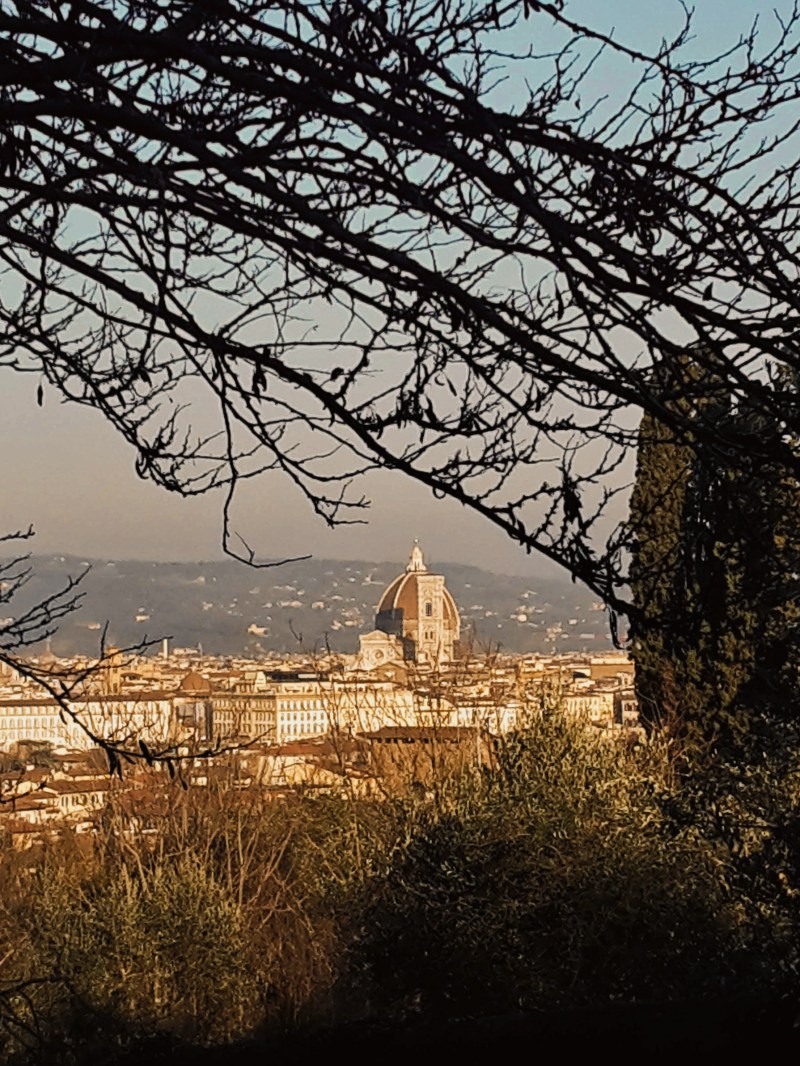
    The Duomo of Florence seen through bare branches from Bellosguardo
    Duomo from Via di Monte Oliveto. Seriously, the picture doesn’t make justice, come see it for yourself

    But, hey! Today is a gorgeous sunny day and before I go out of my way, planning the next hiking adventure, I should make a point to explore the beauty that is so close to home. Most people who come to Florence (and there are millions who come every year, especially during the summer months) visit the main attractions and museums in the city center. Everybody knows not to miss the Duomo, David, the Uffizi, Ponte Vecchio, etc. Slightly more adventurous souls take the short walk up Monte alle Croci, passing the church of San Niccolò and Porta San Miniato, to reach Piazzale Michelangiolo for a stunning panorama of Florence. However, few experience life beyond the city walls where, believe it or not, exist abundant green parks, historical sites and authentic neighborhoods that can truly enrich your visit to the City of Art. I currently live in Oltrarno, outside the city walls (fuori mura, as locals say) at the bottom of the hill of Bellosguardo. A brisk walk uphill leads me to the first local path that I would like to share with you.

    Umbrella pines seen through an iron gate under a brick arch

    Now, this lovely walk is seriously close to home. This is how I usually start my day, walking up and away from any madness happening down in the center of the city (especially when tourist season is upon us). Bellosguardo (Beautiful Sight) offers genuinely beautiful views of Florence, from a less known angle than most visitors are used to when they climb up Piazzale Michelangiolo.

    Narrow lane between walls under yellow-blossomed trees
    Charming Via di Monte Oliveto

    Starting at Via Monte Oliveto, going up from Viale Aleardi, the facade of Santa Maria del Fiore and the gorgeous Duomo is in full view where the street bifurcates. To right the church of San Bartolomeo and the park of Villa Lo Strozzino, to the left a steep uphill toward the church of Santi Vito e Modesto and the Strozzino villa and park. Let’s take left – I like to punish myself and eventually we will loop back here… wait.

    Cypresses framing the rooftops of Florence
    View of Soffiiano from Villa Strozzi

    On a second thought, it is better to appreciate the views of Bellosguardo coming down Via Monte Oliveto. So, we’ll go right instead, reaching the dead end of the narrow street to enjoy a serene view of olive groves and Marignolle in the distance. Here, we also find the church and ex-monastery of San Bartolomeo, which I’ve never seen open to the public, and we continue through the side gate of the park of Villa Strozzi.

    While Giovan Battista di Lorenzo Strozzi conceived the plans for the park and the villa in the XVI Century for his own enjoyment, modern Florentines have free access to a refreshing green space with pine, platanus and horse-chesnut trees, to walk around, play with their kids and let their dogs loose in the reserved area. The villa, stables and the limonaia (where the lemon trees in terracota vases would be kept in the winter months) were completely repurposed in the 1970s to house an institute for contemporary art and design, and promote events during the summer. Behind Villa Strozzi, the panorama opens up toward the southwest of Florence, revealing Isolotto, Soffiano, Scandicci and the Montalbano hills far in the distance.

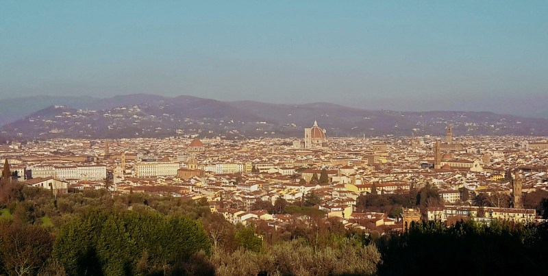
    Panoramic view of Florence from Bellosguardo
    Try to spot the following churches on this view: Santa Maria del Fiore, Orsanmichele, Santo Spirito, Santa Maria del Carmine, Santa Croce, San Frediano, Santa Maria Novella and Ognissanti.

    Continuing downhill on the road or through the dirt paths, we arrive at the elegant main entrance and turn left on Via di Soffiano, which gives us a feel of little Florence, away from the city center, the area is teeming with locals, corner caffè bars and typical trattoria restaurants. It’s a shame this is such a heavily trafficked street. Shortly after, we turn left onto Via San Vito, a slightly steep uphill walk back to Bellosguardo. The traffic noise soon stays behind. At our back, every now and then the stone walls flanking the street open to wonderful views of Soffiano and Bellosguardo. We reach Villa Lo Strozzino and its quiet park and continue right up to Piazza di Bellosguardo, stopping on the way to admire a gorgeous panorama of Florence with the facade of Santa Maria del Fiore cathedral, Palazzo Pitti, Belvedere Fort, Fiesole and the surrounding mountains.
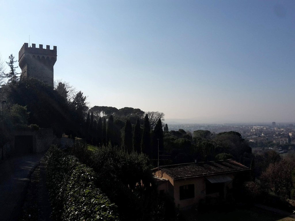
    We arrive at our crossroads in Piazza di Bellosguardo. We will end up back here through Via Piana but for now we will make a slight right turn into Via San Carlo. A few steps forward, we have another breathtaking panorama of Florence by the Montauto castle: cypress trees and umbrella pines lining up on the horizon, the neighborhoods of Isolotto and Novoli down below, Monte Morello watching over them. Via San Carlo is enchanting, its stone walls low enough to allow us to enjoy the green fields and olive groves around the neighborhood.

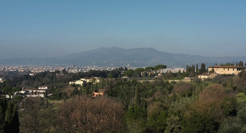
    View across Florence to distant mountains
    Panorama from Via San Carlo

    We descend again into Via di Soffiano, already far from the city center and with a lot less traffic, to soon arrive at the XIX century cemetery of Soffiano. Continuing ahead towards Via del Ferrone takes us on the last uphill hike of this trail and to more panoramic views of Isolotto and Scandicci. Taking a left on Via dei Morelli, a tunnel of oak and cypress trees shades the path that leads us to Marignolle, where it feels like walking in campagna, in the countryside, with vineyards and olive groves dominating the scenery. After passing Villa Tolomei, a high-end hotel nowadays, we soon reach Via Piana again, the ‘flat street’, which will take us back to Piazza di Bellosguardo.

    Villa on a hill above fields and bare trees
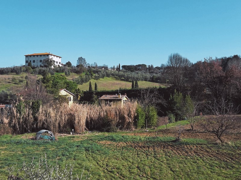
    Via del Ferrone and the 16th century Villa I Visibelli on top of the hill

    From here, it’s downhill to Villa Lo Strozzino and to rejoin Via di Monte Oliveto. We walk by the quaint church of Santi Vito e Modesto and soon we can gasp one last time at the magnificent view of the facade of Santa Maria del Fiore and its Duomo. The ‘Veduta della Catena,’ a XV Century incision by Francesco di Lorenzo Rosselli, immortalized the city in the glory of its early Renaissance from this viewpoint. Then, at the very bottom, we are back at Viale Aleardi, where bus n. 12 takes us back to the city center; or, in the other direction, to Piazzale Michelangiolo in case you haven’t had your fill of panoramic views of Florence yet.

    Did you enjoy this post? Let me know what you think and help me improve the blog!

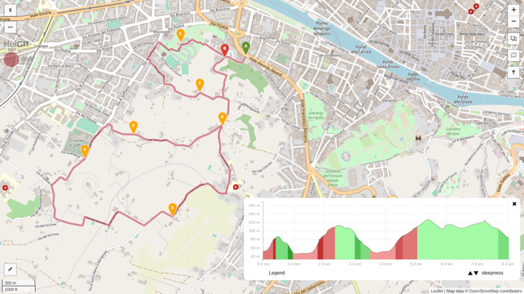
    Trail map of the Bellosguardo walk with an elevation profile

    Bellosguardo-Marignolle-Soffiano

    • 2h00
    • 5mi (8.1km)
    • Depart/Arrive: Via di Monte Oliveto
    • How to get here: Bus n. 12 (Autolinee Toscane) from Ponte alla Carraia (stop Soderini Torrino Santa Rosa or Lungarno di Santa Rosa) going towards Piazzale Michelangiolo (get out at bus stop Sanzio)

    Bus and train timetables in Tuscany change often. If you find a line has changed or a stop has moved, please let other hikers know in the comments below!

    Related hikes: Arcetri and Pian dei Giullari · Along the Arno to Rovezzano · Galluzzo and Impruneta

    Have you found your own quiet corner just outside Florence’s walls? Share it in the comments, I’d love to try it.

  • There and Back Again…

    Florence, Italy

    It’s a dangerous business, Frodo, going out your door. You step onto the Road, and if you don’t keep your feet, there’s no knowing where you might be swept off to. — Bilbo Baggins

    No truer words have ever been written. Decades ago, I was a teenager when I told my mother the world was my home. It was a sincere and spontaneous assessment of my relationship with Earth and my desire to explore it. It took me a few more years, already in Law School, before I boarded the bus that would bring me to where I am now.

    I remember that moment vividly. Memories are stronger when attached to emotions. I was excited, and scared. I had never crossed the border into another country. And there I was, ready to embark, with Bolivia and its famous Death Train as my destination. Machu Picchu and the Atacama Desert – which I had wanted to walk on since I was 10 years old – were part of that journey too, but this story is for another time.

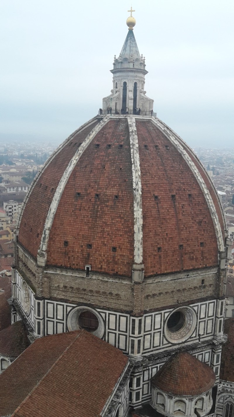
    The Duomo dome of Florence seen from above
    View of Santa Maria del Fiore – the Duomo – from the top of Giotto’s bell tower

    That first trip opened the floodgates that would bring me to Florence, Italy, for the first time in 2007. I applied for Italian citizenship due to my direct descent to a great-grandfather who immigrated to Brazil in the early XX Century. I chose Italy and Italy chose me… Here I fell in love with my wife, Christine, and enjoyed a great life as a hiking tour guide before I moved to the US for a study opportunity. It took me a good five years before coming back, in 2015, with renewed enthusiasm and eagerness to discover more and more about this beautiful country.

    But enough about me. Actually, I’ve never been good at sharing the wonder that I’ve encountered in this world. I want to change that. One thing I’ve learned in my short life is that happiness is sharing. In times when negativity and hopeleness seem to permeate the mainstream waves, I want to share with you the beauty that exists everywhere. Please join me as I start my adventure – I hope you enjoy the ride.

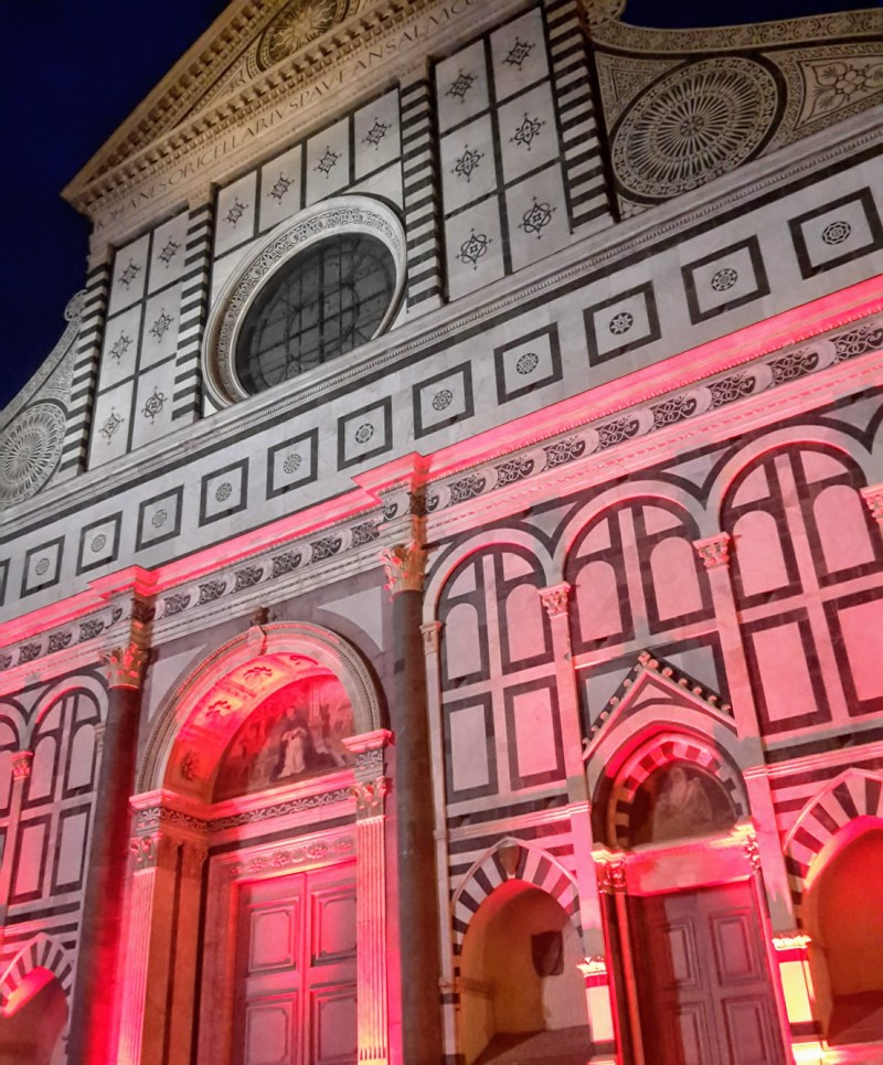
    Marble church facade lit in red at night
    Facade of Santa Maria Novella – original monumental work of Leon Battista Alberti, finished in 1470 (one of my favorite churches in town, definitely worth a visit!)

    Where to start: my Bellosguardo walk, right outside the city walls.

    Planning a hike near Florence? Ask me in the comments, and I’ll point you to the right trail.